Services Overview - Aerovision Drone LLC
Comprehensive Drone Solutions for Agriculture, Land Management, and Commercial Needs
Aerovision Drone LLC is your single-source provider for advanced drone services. Our offerings are designed to solve real problems for farmers, ranchers, land managers, and commercial clients: reduce input costs, improve accuracy, speed up recovery operations, and produce usable data for smarter decisions. Our service suite includes pasture spraying, crop spraying, broadcast seeding, deer recovery, herd analysis, aerial drone services including mapping and photography, and commercial drone operator services for hire.
Why Aerial Drone Services Matter
Modern agricultural and land management challenges require flexible solutions that deliver precision without added risk. Drones fill that role by offering:
Targeted applications that reduce chemical runoff and overspray.
Rapid assessment of crop and pasture health via multispectral imaging.
Efficient re-seeding of hard-to-access areas with broadcast seeding technology.
Quick and humane recovery of lost livestock and pets, minimizing losses.
High-quality aerial imagery and mapping for planning, marketing, and compliance.
Key Benefits of Each Core Service
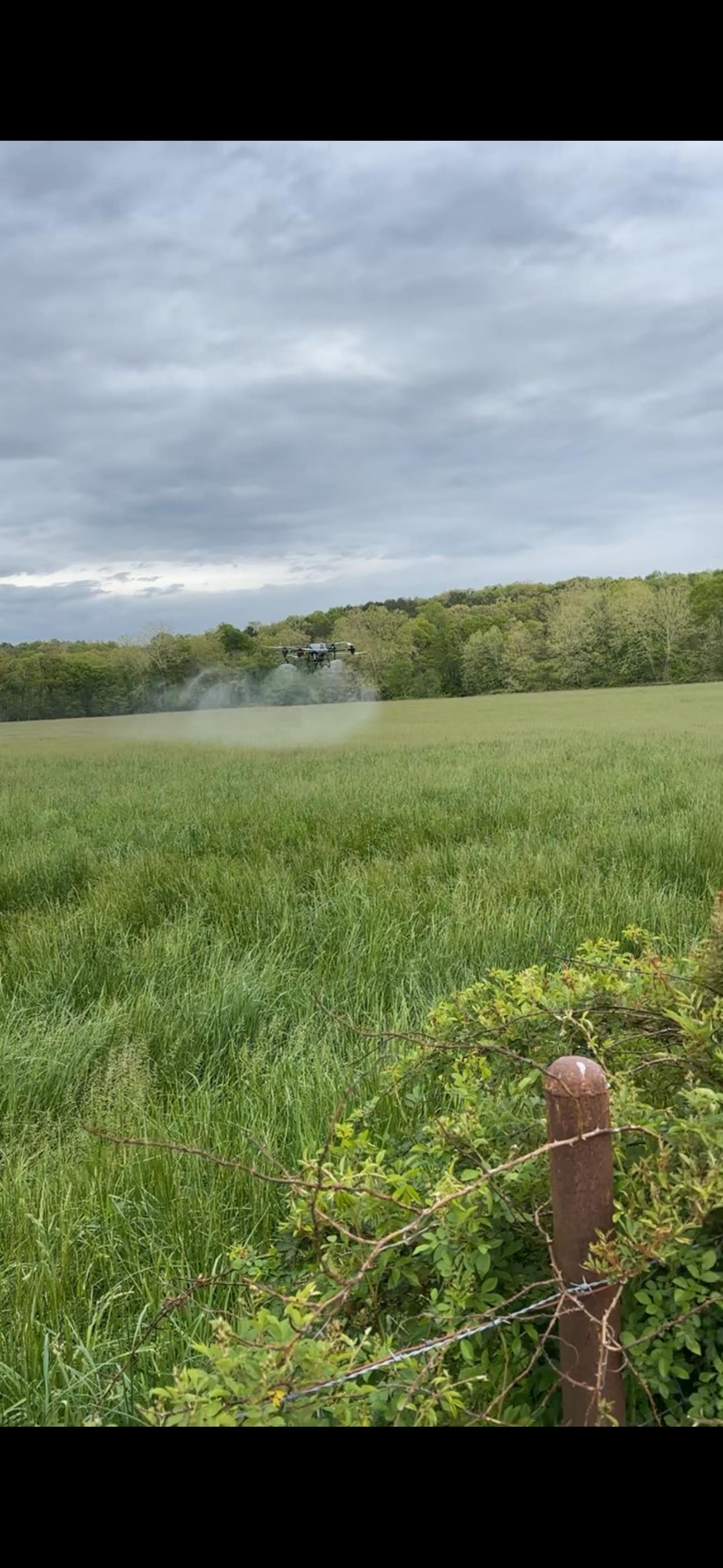
Pasture Spraying
- Effective control of invasive weeds, brush, and pests.
- Reduced ground compaction and labor because no heavy machinery is needed.
- Uniform coverage across uneven terrain and steep slopes.
Crop Spraying
- Precision application for fungicides, herbicides, and foliar feeds.
- Decreased chemical use and improved ROI due to targeted spraying.
- Rapid treatment during critical windows to protect yields.
Broadcast Seeding
- Fast reseeding of pastures, terraces, and reclamation sites.
- Even seed distribution across variable terrain.
- Ability to seed inaccessible areas without heavy machinery.
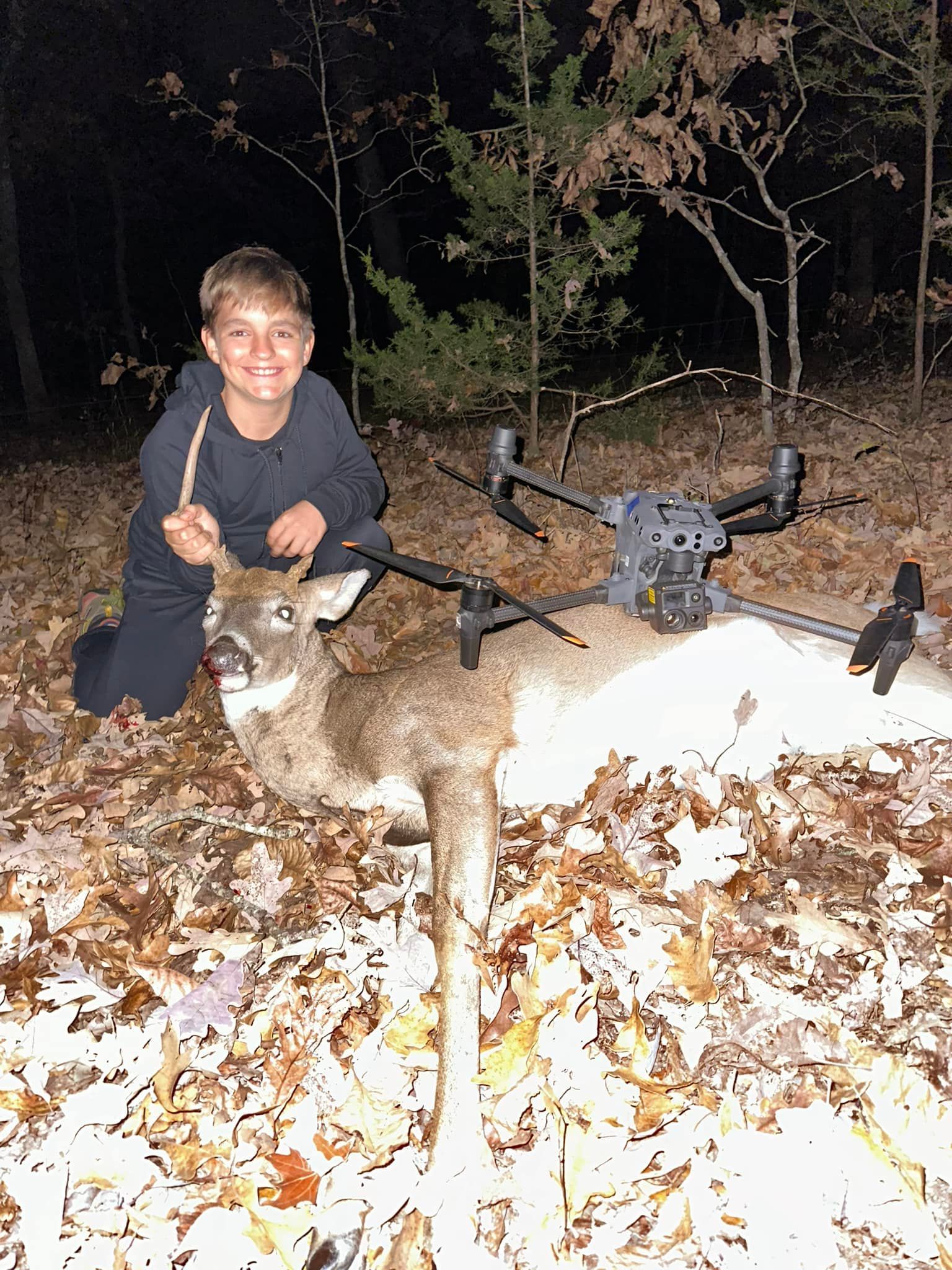
Deer Recovery and
Livestock/Pet Recovery
- Rapid aerial search capabilities cover large search areas quickly.
- Less animal stress and faster reunification with owners.
- Useful for locating lost animals after storms or escapes onto rough terrain.
Aerial Drone Services (Mapping and Photography)
- High-resolution orthomosaic mapping for acreage measurement and planning.
- NDVI and multispectral analysis for crop stress and nutrient management.
- Professional aerial photography for property listings, marketing, and documentation.
Commercial Drone Operator Services
- Licensed drone pilots available for hire for inspections, surveys, marketing, and special projects.
- Project-based piloting for operations that require FAA-compliant professionals.
How Aerovision Drone LLC Executes Each Service
1. Planning and Preparation
For every job we conduct a pre-flight assessment, verify local regulations and product labels, and create a flight plan tailored to the objective.
2. Safety and Compliance
We use checklists, maintain insurance, and follow required best practices to ensure safe operations.
2. Safety and Compliance
We use checklists, maintain insurance, and follow required best practices to ensure safe operations.
3. Precision Execution
Whether applying product or collecting data, we perform flights using calibrated systems and documented routes to ensure consistent coverage.
4. Reporting and Insights
All jobs conclude with a detailed report—application rates, maps, and imagery that support future decisions.
4. Reporting and Insights
All jobs conclude with a detailed report—application rates, maps, and imagery that support future decisions.
Service Packages and Pricing Philosophy
We offer flexible pricing to fit different customer needs:
Acre-based pricing for spraying and seeding where rates are clear and scalable.
Project pricing for mapping, photography, and recovery where variables like acreage or complexity drive cost.
Seasonal contracts for multi-pass needs like pest control and repeated mapping for crop development tracking.
Technologies and Capabilities
Agricultural Spray Drones: Equipped with multiple nozzle systems, flow meters, and GNSS for consistent droplet size and application.
Multispectral Sensors: For NDVI and vegetation analysis to identify stress zones or nutrient deficiencies.
High-Resolution RGB Cameras: For clear aerial photography and orthomosaic generation.
Broadcast Seeders: Specialized hoppers and spreaders for uniform seed distribution.
Advanced Flight Planning Software: For efficient pathing, obstacle avoidance, and automatic data logging.
Safety and Environmental Considerations
We choose products and practices that limit environmental impact. Targeted applications reduce the amount of chemicals entering soils and waterways. When herbicides or pesticides are necessary, we strictly follow label rates and buffer zone guidelines. Safety steps include:
Wind and weather assessments before flights
Notification protocols for nearby residents and operators
Proper container handling and secure transport of agricultural inputs
Use Cases and Success Metrics
Pest control: Reduced infestation zones by targeted spraying, with follow-up mapping showing recovery.
Pasture improvement: Broadcast seeding increased forage cover and reduced bare soil.
Crop protection: Timely crop spraying prevented disease spread and preserved yield potential.
Recovery operations: Rapid aerial searches that significantly reduced the time animals were missing.
How to Choose the Right Service for Your Needs
If you have a pasture with weeds and rough terrain: Pasture Spraying and Broadcast Seeding.
If you have row crops with localized pest pressure: Crop Spraying and Aerial Mapping.
If you need lost livestock or pets found quickly: Deer Recovery and Livestock/Pet Recovery.
If you need accurate acreage maps or documentation: Aerial Drone Services for mapping and photography.
If you need a licensed operator for specialized flights: Hire our Commercial Drone Services.

Frequently Asked Questions
Do you handle permits for aerial spraying?
Yes. We help manage compliance and operate in accordance with EPA and FAA guidelines as applicable.
How soon can you start a job?
Scheduling depends on workload and weather, but we aim for timely mobilization, especially for emergency recovery operations. Call (573) 578-5005 for a faster response.
Are your pilots insured and licensed?
Yes. Our pilots are Part 107 certified and our operations are covered by commercial insurance.
Can you provide long-term contracts for seasonal needs?
Yes. We offer seasonal and multi-pass contracts for recurring spraying, mapping, or recovery monitoring.
book now
Contact Us
We will get back to you as soon as possible.
Please try again later.
Contact Us
To discuss options and get a customized plan, call (573) 578-5005 or visit our base at 398 Route CC, Linn, MO 65051. We’ll evaluate your property, identify goals, and provide a clear proposal.